Baton Rouge Audubon Sanctuaries
Peveto Woods Sanctuary
Amite River Wildlife Sanctuary
Mission Statement
The Baton Rouge Audubon Society's Sanctuaries provide:
Protection of diminishing habitat for birds, butterflies and other wildlife with special emphasis on Neotropical migrants;
visitors with the opportunity for nature study such as birding, butterfly watching and photography; and
a means to promote wildlife education, research, and conservation in cooperation with others including the residents and organizations of parishes in which the properties are located.
Peveto Woods Sanctuary
The Baton Rouge Audubon Society Peveto Woods Sanctuary currently encompasses approximately 40 acres and is located along the Louisiana coast in Cameron Parish. This site was the first chenier sanctuary for migratory birds established in Louisiana.
Coastal woods were called cheniers by early French settlers. The word means oak place, so-called because live oak was the predominant tree. Cheniers are ancient beach ridges, formed by wave action, offshore currents, and the influence of the Mississippi River. They are a unique feature of the northern coast of the Gulf of Mexico, found primarily along the Louisiana coast.
Baton Rouge Audubon Society is proud to have preserved this unique habitat. Birders and other nature lovers have visited the Sanctuary from 50 states and 20 foreign countries. Although the Sanctuary is owned and operated by the Society, we are dependent on private donations for maintenance costs and land purchases. Because of the generosity of private individuals and groups, BRAS has been able to maintain and add to this important site.

Directions
To get there from Interstate 10 drive south on Hwy 27 at Sulphur, LA until it intersects Hwy. 82 at Holly beach (33 mi.); go west (right) for 8.5 miles on Hwy 82; look for the BRAS Sanctuary sign on the left, turn left and follow the road to the sanctuary on the left.
Hours of Operation and Facilities
The sanctuary is unmanned. No admission is charged. It is accessible from dawn to dusk every day, 365 days of the year. There are a few picnic tables and a pavilion for seating and shade. There is a port-o-let on site. Please "pack it in, pack it out" and do not leave trash onsite as there is no trash pickup.
Significance of the Sanctuary
Peveto Woods Sanctuary Louisiana lies in the center of the flight path of migratory birds crossing the Gulf of Mexico. An enormous number of migratory songbirds pass over the Cameron Parish coast each spring and fall. In their studies of bird migration, ornithologists George Lowery and Robert Newman found that in the spring when the wind is from the south and the weather is clear, most migrants pass over the coastal areas to land miles inland. However, when the wind is from the north, the birds tire and barely make it to the first land they sight. This makes the Louisiana coastal woodlands critical to the survival of tiny songbirds in need of rest, food and cover. As many as two million birds use our sanctuary each year.
Since 1984, scientists from the University of Southern Mississippi have used the sanctuary as a site for research on migrant songbirds. Their findings further document the importance of this habitat to songbirds. When birds reach the Louisiana coast, their energy reserves are exhausted. Without coastal woodlands for a resting and feeding area and for protection from predators and weather, some portion of millions of songbirds which nest in the United States and Canada probably would not survive. Recent evidence indicates that the sanctuary is used by the migratory Monarch butterfly, as well as many other butterflies.
History of the Area
Peveto beach woods, once a tract of about 50 acres, became popular among ornithology students and birders, especially during the spring and fall migratory periods, when large numbers of trans-Gulf migrants appear in the woodlands. In the 1970's and early 1980's, the tract began to shrink as various owners began selling off sections of the property. In 1978, the owners partitioned the property and half of it was sold to developers for a residential subdivision. In 1984, a small group of concerned birders decided to try to save what was left.
In August 1984, through the generosity of Mr. Robert W. Holleyman of Lake Charles and Dr. Carlton Sheely, III, of Baton Rouge, the first tract of six acres was purchased. Several small parcels were added in the following two years. In July 1989, the Henshaw Sanctuary was created with the sale and donation of the unsold portions of the subdivision by Mr. H. Marsh Henshaw, III, of Sulphur. Subsequent additions of several undeveloped lots came in August 1990 and February 1992. In 1993, 27 acres were added on the north side reaching up to La. Hwy. 82. In 1994, we filled in one of the sand pits and replanted about six acres with 1,600 live oak seedlings. Restoration projects of various kinds have been ongoing ever since.
Amite River Wildlife Sanctuary
This 36-acre sanctuary is located near the Amite River between Prairieville and Port Vincent, Louisiana. The sanctuary features mostly cypress-tupelo swamp with palmetto and some areas of pine and other hardwoods.
Location
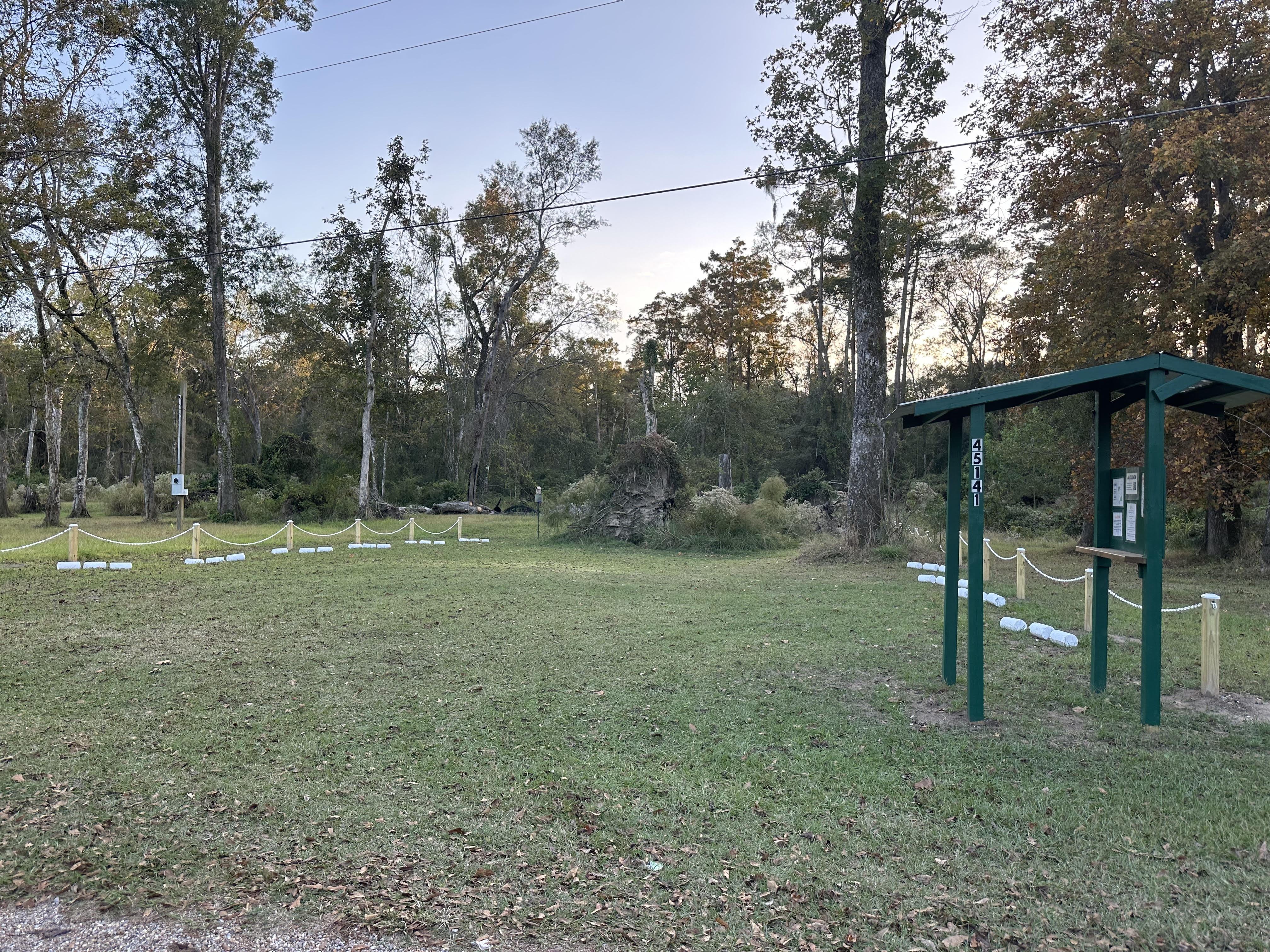
The address is 45141 Manny Guitreau Rd, Prairieville, Louisiana. Please note that GPS takes you slightly beyond the sanctuary, so look for kiosk and sign.
Directions: from the traffic circle at the intersection of LA 431 and LA 42, go south on LA 431 and turn immediately past the traffic circle on to Manny Guitreau Rd (it's easy to miss!). Look for the green kiosk / sign and parking area. Please honor sanctuary boundary signs to avoid trespassing on neighboring properties.
Parking: please park in the grassy area in the front of the sanctuary between the fencing. The parking is angle-in to maximize the number of cars (12 spaces total). Overflow parking can be arranged with prior notice (notify Jane at president@braudubon.org if you need this). Please do not park on neighbors' property without permission.
Hours of operation and facilities
The sanctuary is unmanned. No admission is charged. It is accessible from dawn to dusk every day, 365 days a year. There are no bathrooms on site (closest bathroom is at Fred’s on the River convenience store/restaurant to the north across the traffic circle). There is apicnic table near the trailhead. Please “pack it in, pack it out” and do not leave trash on site as there is no trash pickup.

Trails As of March 2024, all trails are marked orange trail posts and signs. Please refer to the trail map and information below. These trails are primitive; there are no boardwalks and there are tripping hazards, mud, and wet spots. Knee-high boots are generally recommended! A walking stick (available near the picnic table is highly recommended. Click here for trail map and info
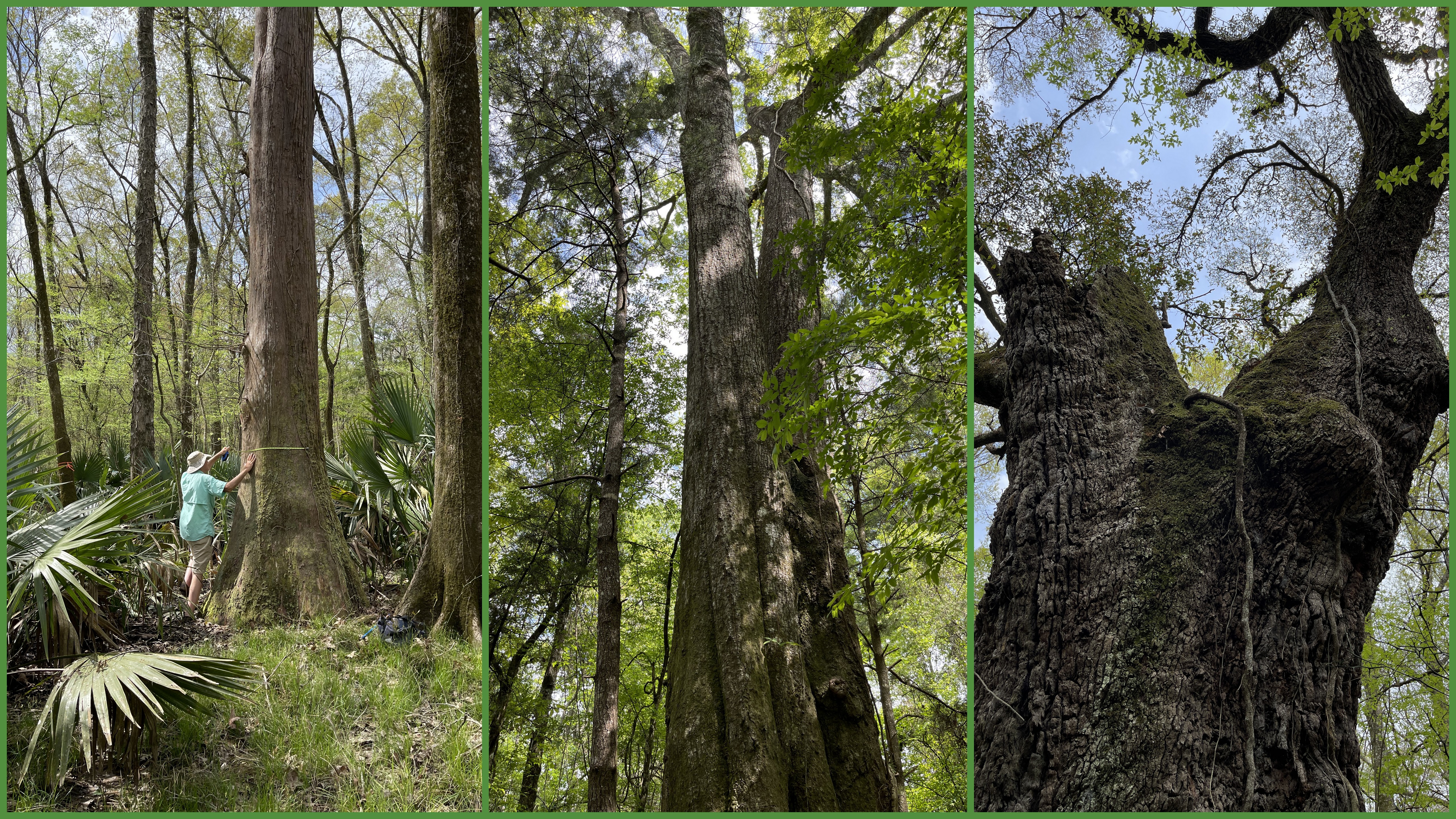
Features The trail designated on the map as the Otter Loop to the east leads you from the trailhead to the southeast first to a legacy cypress tree. This tree was dated by the Louisiana Purchase Cypress Legacy organization and is estimated to be between 400 and 600 years old. There are several other majestic cypress in the swamp areas of the sanctuary. If you continue on the trai and turn right on Red Fox Traill, you will find the lone Live Oak on the property. This ancient tree is standing on a bit of raised land, which is undoubtedly the reason it has survived in the swampy environment. At approximately 23 feet in circumference, calculations estimate the tree to be at least 350 years old. Both of these trees are marked with commemorative brass plaques with their names in the Chitimacha langage. Please visit this page to read the story of The Naming of the Trees.
On the west side of the sanctuary stands a unique feature; a true twin oak with a double trunk that starts from the base and soars 100 feet or more in the air.
There is a good sized pond on the southern border of the property that often features Wood Ducks and even wading birds.
Birds
Birders are encouraged to create ebird lists for their visits to the sanctuary. Please save the lists to the designated hotspot: Baton Rouge Audubon Amite River Wildlife Sanctuary.
Click here to explore the most recent and historic list of birds seen at this location:
Plants
Through a grant awarded by the Atchafalaya Natural Heritage Area, we have installed interpretive signage at the sanctuary to identify various plants on the property. Each marker contains the common name of the plant, the scientifc name, the plant type and a QR code. Point your smartphone's camera at the QR code and you will be linked to a webpage with useful information about the plant, such as its habitat, landscape and medicinal uses, and how you might grow this plant in your own landscape.

Other Flora and Fauna A geographical project for this sanctuary has been created in iNaturalist. That means that any observations made with iNaturalist are automatically collected and included in this project. Anyone can participate. BRAS Amite River Wildlife Sanctuary iNaturalist project
Historical and Cultural Significance This property is located on the eastern edge of the Atchafalaya River Basin and falls within the state-designated Atchafalaya Natural Heritage Area. Visit Atchafalaya.org for information about culture and history as well as outdoor recreation information in the area.
Just across the river near the bridge in Port Vincent there is a marker that was placed in 2021 to designate the site as part of the William Bartram Trail. William Bartram was an explorer and naturalist who documented the flora, fauna and people of the southeast United States from 1773-1777. In his book Travels he describes traveling from Lake Pontchartrain through Lake Maurepas and up the Amite River to Baton Rouge and eventually ended that part of his journey in Pointe Coupee parish. For more information on the Bartram Trail, visit: The Bartram Trail
The Chitimacha Tribe, one of four sovereign indigenous tribes in Louisiana recognized by the federal government, probably resided in this area historically, as their original territory spanned much of what today is designated as the Atchafalaya river basin. The tribe has a reservation and museum in Charenton, Louisiana. Chitimacha Indian Tribe To honor the indigenous people of the area, it was decided to name our legacy trees with Chitimacha language names. Please visit this page to read the story of The Naming of the Trees.
